I’ve been excited for over a week now, getting ready for a long trail run in Lake Tahoe with my trail running club, the Donner Party Mountain Runners (DPMR) and my friend Sara. Sara just kicked cancer’s butt two weeks ago, and now she was ready to go kick some butt on the trail in the Sierras. The route was designed by Chris C. from our club, but he’s a kick-ass mountain runner that lives at 7,000 feet year ’round. We had some pretty tough climbs on this route, with our hearts in our throat the first couple miles to the ridge. The rewards from all of our hard work paid off though, with unbelievable vistas and panoramas of the Lake Tahoe Basin and Granite Chief Wilderness.
Since we were meeting at the trailhead at 0745 in the morning, with a start time of 0800, we needed to be up there the night before. The closest place I could get to the Five Lakes Trailhead in the Olympic Valley near Alpine Meadows ski resort was Donner Memorial Campground. It was nice, but expensive for what you get. My senior discount didn’t help much with the State Parks. With the drought, the showers were only turned on Thursdays and Saturdays if I recall.

East end of Donner Lake Campground

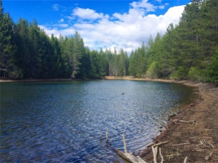
Donner Lake showing lack of water
That afternoon after making camp, we took a dry run to the Five Lakes Trailhead. It was several miles up the canyon from Highway 89. When we got there, some men were repairing and cleaning up the trailhead from the recent rains. A good 20 minutes travel time to the trailhead from the campground, I gave myself 30 minutes to get there in the morning.

GPS track of run

Elevation profile

Stats
Rise and shine, revellie at 0600…we arrived at the trailhead at about 0740, with members already getting ready to hit the trail. After a few formalities, getting the trail map (somewhat useless…too tiny to read) and signing the waiver, we all amassed for a group photo before heading up the hill. And it was literally “UP” the hill. Not living at altitude and trying to run right out of the gate is tough. I was wearing my heart rate monitor, but no need to look and see where my heart rate was…I knew where it was…it was in my throat! The good thing about having to stop so much is that you got to look around and enjoy where you are, take pictures, smell the fresh air and lavish in my element.

Ridge above Alpine Meadows

Sara pondering the ascent

We’re off like a herd of slugs

Beginning the trek

Five Lakes Trail

Beautiful views of our immediate goal

Closer to the ridge

Time for a breather
Agony led to ecstasy when we finally reached the ridge. Great views to look back on at the trail junction of Five Lakes Trail to the PCT. We’re now are hiking downhill just to make the hike back up the hill with switchbacks ad infinitum. Crossed a small stream, the outflow from Five Lakes. There were a couple of Northbounders off the PCT camping near the creek as we passed. Now for the climb to the ridge-line. Switchbacks…many switchbacks. Sara was not fond of them and preferred a ladder so we could get to the top quicker.

Meadow with about five Western Tanagers flying about

California Tiger Salamander out of his element – water is about one mile back. Right in the middle of the trail.

Sara and the switchbacks

Nearing the ridge
We finally reach the ridge line, and are treated to incredible views in every direction. We can now catch a glimpse of Tahoe to the east, Alpine Meadows Ski Resort below us, the Granite Chief Wilderness to the west, and Desolation Wilderness to the southwest.

Alpine Meadows

Looking toward the lake

Pano from the ridge

Barren ridge

Sara on the ridge PCT near Ward Peak and Alpine Meadows
There was a cool breeze on the ridge to keep us cooled off, which became cooler when we stopped for a rest or a bite. I made sure Sara was eating something, as we couldn’t afford for her to “bonk” up here…it was a long way back to civilization. When you are on long distance legs of a trip, you have to force yourself to eat and hydrate before it’s too late. We both took SaltStick also for electrolyte balance as well. The problem with this course is water sources – the first source was about 5 miles in, when you have enough water – and the second was at Ward Creek, less than 2 miles from the finish at the lake. We had room for more water, but you have to draw the line about how much you’re willing to carry sometimes. A heavier pack can also mean less enjoyment along the way, so you decide. If I did it again, I would throw in one more 20 oz. bottle for insurance.
Though we could see Twin Peaks from Ward Peak, it seemed to take eons to get there. We met up with several “Northbounders”…most very nice…some chatty like “Driver” and his pretty wife “Pit Stop” from Mississippi that found a common language with Sara. They were on a thru-hike on the PCT, and were holding up very well. Others on the trail very focused, or withdrawn, or just plum tuckered out and didn’t have much to say. Oh well, it’s all good.

Just happy to be here

Out-of-bounds backside of Alpine Meadows

You make it past this fence, you have a long climb back up

Lonely wind-blown tree

Holding up the the steady wind on the ridge

Volcanic knob

Trail behind the ridge now until the TRT

Looking back from where we came

Nearing the ridge

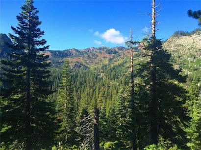
Granite Chief Wilderness to the south

Basalt cliffs

Had to make her stop for a photo-op

Sara off in the distance

Chinese Dragon tree
We finally found ourselves on the backside of Twin Peaks and our waypoint, turning onto the Tahoe Rim Trail from the Pacific Crest Trail. I had been here last year in June with the snow at Twin Peaks, but the trail was obscured by snow and debris, I never got to summit the peak. Sara was much too tired and we were so far behind schedule, it would have to wait for another time once again. (I never need much reason to come back and do it again)

TRT and PCT junction

Twin Peaks south peak

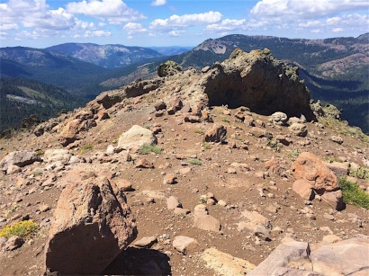
Rockpile at base of Twin Peaks, South Peak

View from Tahoe Rim Trail to the south

Stanford Rock Ridge

Trail Junction to Stanford Rock
Once again on the saddle between Twin Peaks and Stanford Rock, we could see down into Ward Canyon, where the Rim Trail continues. It may have been easier climbing-wise for Sara, to take the TRT down the mountain, but it was longer by at least one mile. One more mile I didn’t know if she had in the tank. We continued on to Stanford Rock Trail, which was a steep and loose climb. We stopped and waited for about 8 MTB cyclists on the way down the hill – it was very steep and they needed all the room to keep from doing an “endo” on top of us.
The climb to this ridge was tough, especially when you’re really getting trail-weary. When we finally could see the lake, it looked miles away at best.

“Miles to go before we sleep…”
The trail drops in altitude very slowly, so we didn’t feel like we were advancing to our destination very quickly. Switching directions, back and forth, we felt like we were in a mouse labyrinth. I tried to cheat a little for Sara’s sake and make it to Ward Creek Blvd., and get her to hitch a ride to the end. Poor thing was spent, but kept at it and never gave up until she accomplished her mission. We finally made it to Ward Creek, but needed to find a way across. There was enough water flowing to get our feet and shoes about one foot deep in the cold water (which really wouldn’t have been such a bad thing at this point). We extended our trekking poles and chose our rocks carefully to make it across with no trouble.

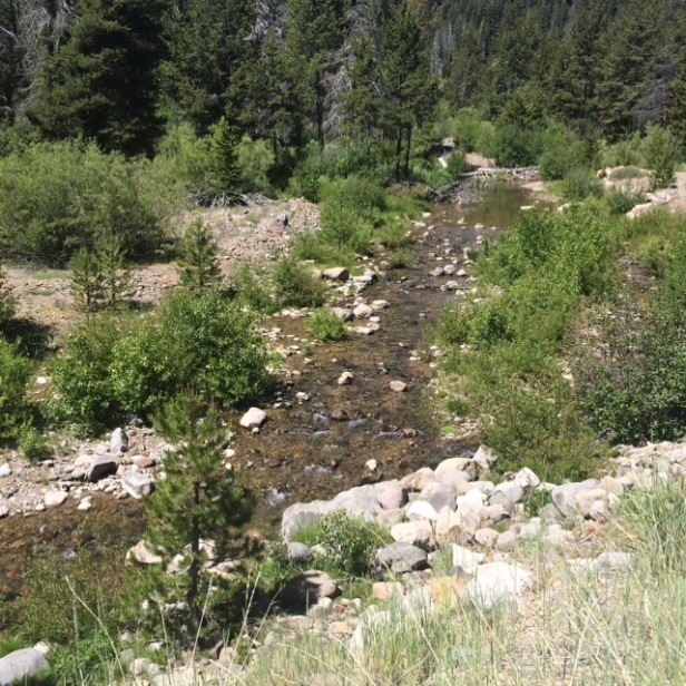
Ward Creek
Once back at the road, we tried our luck with hitch-hiking our way back to the beach, so we could hopefully get a ride back to the car in Alpine Meadows. (I know that I couldn’t get a ride if my life depended on it here in Tahoe…I know, I’ve tried it several times and failed miserably. Nobody picks up old guys, even with pretty legs) But a pretty young woman with her thumb out is another story. After several attempts, one local guy with his friendly dogs in the van stopped and gave Sara a ride to the beach area where we were supposed to meet our friends to get back to the car. There was only room for one in the van with the dogs using up more than their fair-share. No problem, I still had a little left in my tank to get back. Finally, Sara and I met up at the beach to find that nobody had waited for us or left word that they were coming back at anytime soon. It was now after 6PM and we needed to get back to the car somehow. I finally reached one of the run organizers and had her come back to get us, all the way from Truckee.
Looking back it was quite a day, and Sara had much to be triumphant about. Two weeks prior, she had kicked cancer’s butt and today she kicked some big mountain butt in Tahoe. Much to be proud of, and bragging rights to boot!
In the immortal words of Peter Quincy Taggert…
“Never give up…never surrender!”
Now it’s time for a little kick-back time at the end of the long day with a campfire, some hot cocoa and of course peanut butter for me…a staple for us Marmots.
Tomorrow we head for Barker Pass for a short hike and view from one of my favorite campsites. Many flowers in bloom this time of year so we’ll be taking pictures of some of the plants in this section of the Tahoe Rim Trail.
Until then…I’ll see you on my next adventure,
somewhere in the Tahoe Wilderness.


